Colusa Subbasin Project & Management Actions (2022)
The purpose of this form is to gather ideas for potential projects and management actions (PMAs) that could be evaluated and possibly be included in the Colusa Subbasin GSP. The initial Colusa Subbasin GSP was submitted in January 2022 and contains PMAs that were submitted during the GSP development process. Now that the GSP has been submitted and we are looking toward implementation, the GSAs have re-opened the PMA Submittal Form to collect additional suggestions and ideas to help the Colusa Subbasin reach and maintain sustainability. It is important to recognize the GSP is a living document and must be adaptive.
Potential PMAs may fall under several categories, including but not limited to the following:
- Recharge projects
- Supply augmentation projects
- Water conservation projects
- Projects to reduce non-beneficial consumptive use
- Groundwater pumping allocations
- Monitoring programs (groundwater pumping, water levels, stream flows, etc.)
An online version of this form can be accessed at https://arcg.is/eWTbn or use the QR code below. This is the preferred submittal method.

Please share YOUR ideas by completing and submitting a PMA Submittal Form. Submittals are due September 8, 2022 at 11:59 pm. To submit:
- Online submittal or use QR code above: Electronic submittal (preferred method)
- Microsoft Word version: Email or print and mail
- PDF version: Email or print and mail
| Email to: | LHunter@countyofglenn.net |
| Mail to: |
Glenn Groundwater Authority ATTN: Lisa Hunter 225 N. Tehama St. Willows, CA 95988 |
| Attachment | Size |
|---|---|
| Colusa Subbasin PMA Form (8/2022)- Microsoft Word Version (41.49 KB) | 41.49 KB |
| Colusa Subbasin PMA Form (8/2022)- PDF version (131.76 KB) | 131.76 KB |
Colusa Subbasin Projects & Management Actions (2020)
Colusa Subbasin GSP Projects and Management Actions (PMAs) Submittal Form
The purpose of this form is to gather ideas for potential projects and management actions (PMAs) that could be evaluated and ultimately included in the Colusa Subbasin GSP. Once ideas are gathered, an initial screening and evaluation process will be conducted, followed by ranking of potential PMAs for more detailed evaluation and inclusion in the initial GSP. Potential PMAs may fall under several categories, including but not limited to the following:
• Recharge projects
• Supply augmentation projects
• Water conservation projects
• Projects to reduce non-beneficial consumptive use
• Groundwater pumping allocations
• Monitoring programs (groundwater pumping, water levels, stream flows, etc.)
Please share YOUR ideas by completing and submitting a PMA Submittal Form. Submittals are due May 3, 2021 at 5:00 pm. To submit:
- Google form: Electronic submittal (you do have to log in to your google account to access this option)
- Microsoft Word version: Email or print and mail
- PDF version: Email or print and mail
| Email to: | LHunter@countyofglenn.net |
| Mail to: |
Glenn Groundwater Authority ATTN: Lisa Hunter 225 N. Tehama St. Willows, CA 95988 |
| Attachment | Size |
|---|---|
| Colusa Subbasin PMA Form (12/2020)- Microsoft Word version (90.34 KB) | 90.34 KB |
| Colusa Subbasin PMA Form (12/2020)- PDF version (122.49 KB) | 122.49 KB |
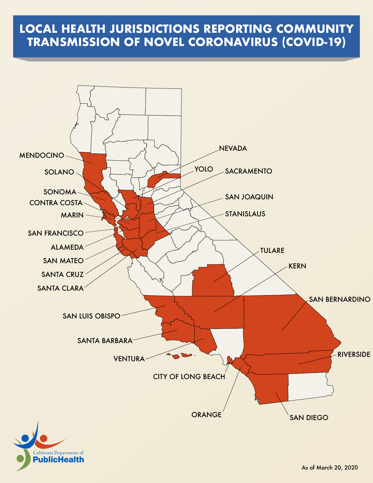
Local Health Jurisdictions Reporting Community Transmission COVID-19
| Attachment | Size |
|---|---|
| COVID-19 California Community Transmission Map 3.20.20 (220.59 KB) | 220.59 KB |
Special District Maps
| Attachment | Size |
|---|---|
| Rice Pest Abatement District #1 Maps (8.65 MB) | 8.65 MB |
Glenn Groundwater Authority Executive Committee Special Meeting- July 9, 2018
| Attachment | Size |
|---|---|
| GGA Executive Committee Agenda- July 9, 2018 (292.84 KB) | 292.84 KB |
| GGA Executive Committee Meeting Minutes- July 9, 2018 (426.55 KB) | 426.55 KB |
Glenn County Road & Bridges Project Map 2017
| Attachment | Size |
|---|---|
| Glenn County Road & Bridges Project Map 2017 (282.57 KB) | 282.57 KB |
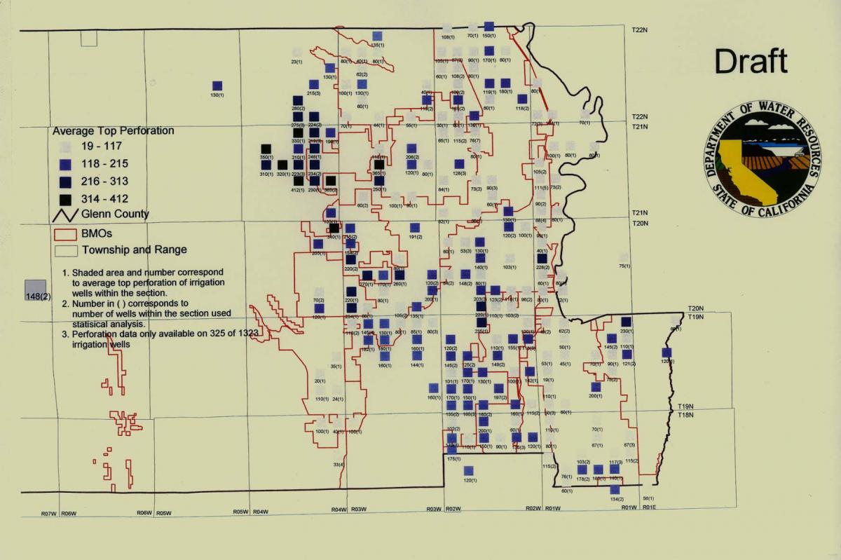
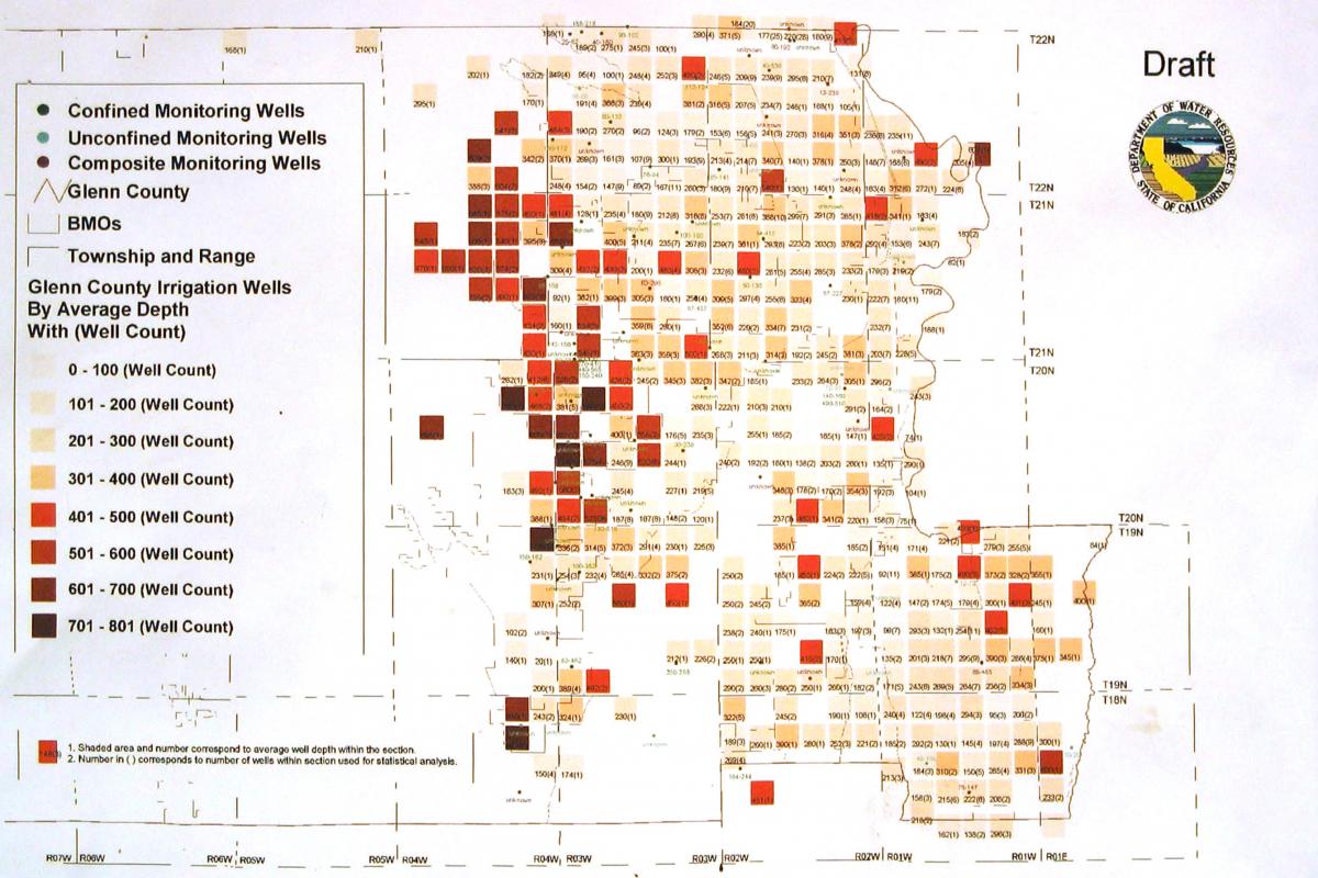
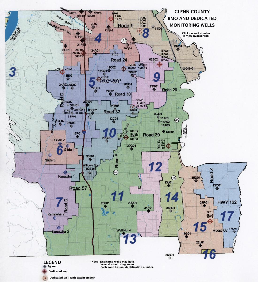
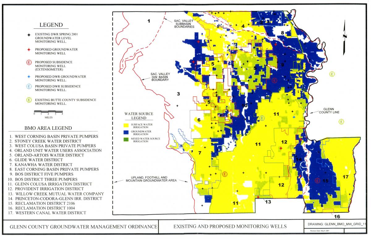
Dedicated Monitoring Wells
| Attachment | Size |
|---|---|
| Dedicated Monitoring Wells (214.46 KB) | 214.46 KB |
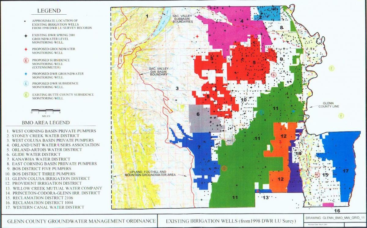
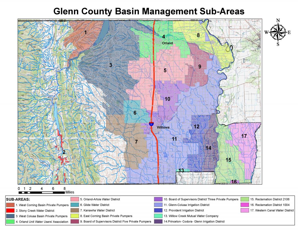
Glenn County BMO Sub-Areas
| Attachment | Size |
|---|---|
| Glenn County BMO Sub-Areas (246.32 KB) | 246.32 KB |
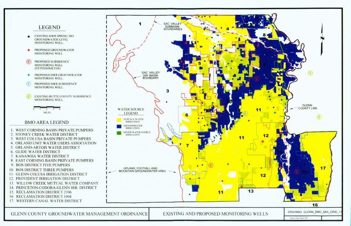
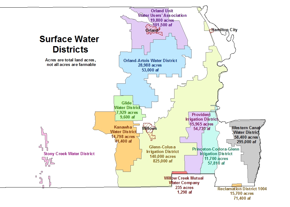
Map of Water Sources in Glenn County
| Attachment | Size |
|---|---|
| Water Sources in Glenn County (164.7 KB) | 164.7 KB |
Orland Area Of Concern Map 2005
| Attachment | Size |
|---|---|
| Orland Area Of Concern Map 2005 (113.07 KB) | 113.07 KB |
Underground Storage Tank - Site Map (Sample)
| Attachment | Size |
|---|---|
| Underground Storage Tank - Site Map (Sample) (71 KB) | 71 KB |
Hazardous Materials Business Plan - Facility Map
| Attachment | Size |
|---|---|
| Hazardous Materials Business Plan - Facility Map (1.04 MB) | 1.04 MB |