Displaying 1 - 20 of 56
Hazardous WAste Removal Followinf Wildfire
Updated:
HAZARDOUS WASTE REMOVAL, ASBESTOS AND SOIL SAMPLING CONTRACTORS - October 2020
| Attachment | Size |
|---|---|
| Hazardous Waste Removal, Asbestos and Soil Sampling Contractors.pdf (150.25 KB) | 150.25 KB |
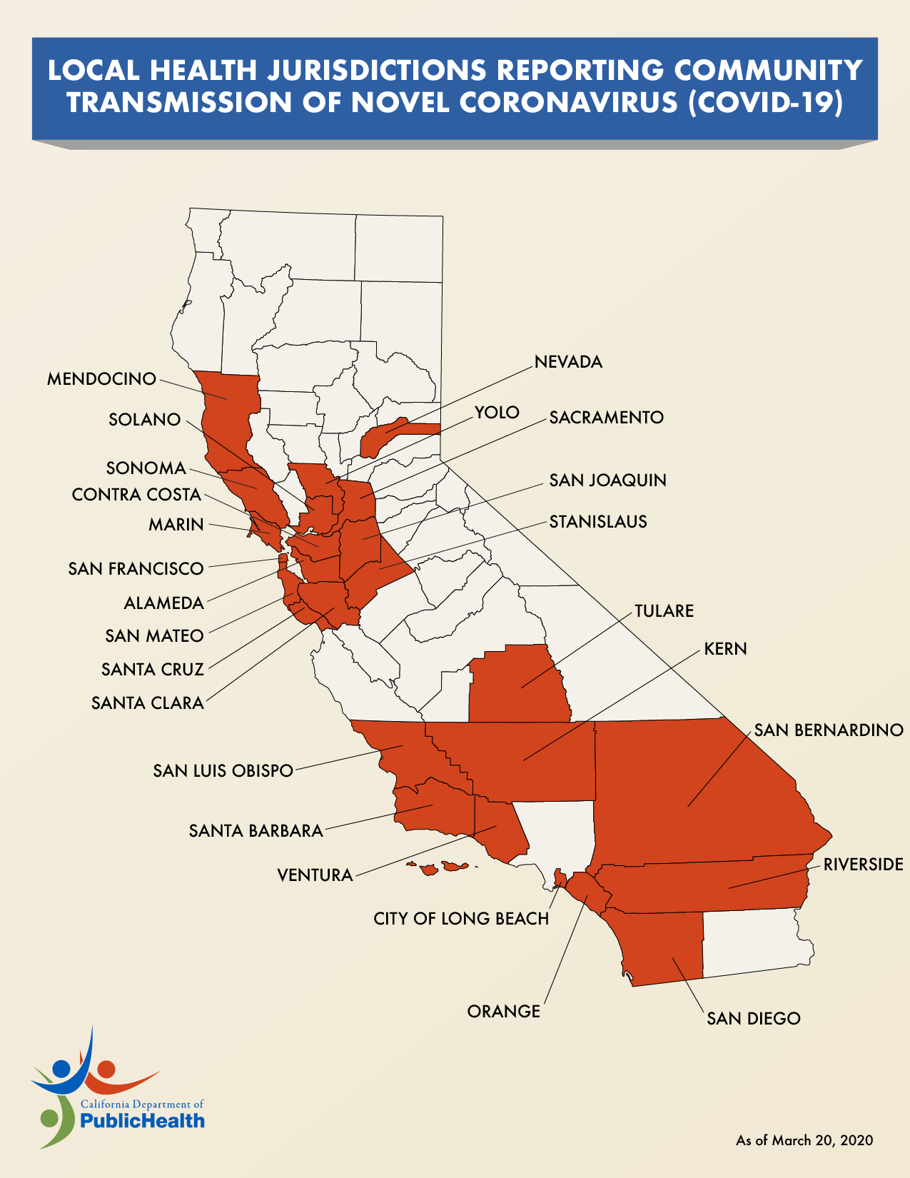
Local Health Jurisdictions Reporting Community Transmission COVID-19
Updated:
| Attachment | Size |
|---|---|
| COVID-19 California Community Transmission Map 3.20.20 (220.59 KB) | 220.59 KB |
Special District Maps
Updated:
| Attachment | Size |
|---|---|
| Rice Pest Abatement District #1 Maps (8.65 MB) | 8.65 MB |
Statement of Understanding and Compliance UST
Updated:
| Attachment | Size |
|---|---|
| Statement of Understanding and Compliance (104.48 KB) | 104.48 KB |
Glenn County Road & Bridges Project Map 2017
Updated:
| Attachment | Size |
|---|---|
| Glenn County Road & Bridges Project Map 2017 (282.57 KB) | 282.57 KB |
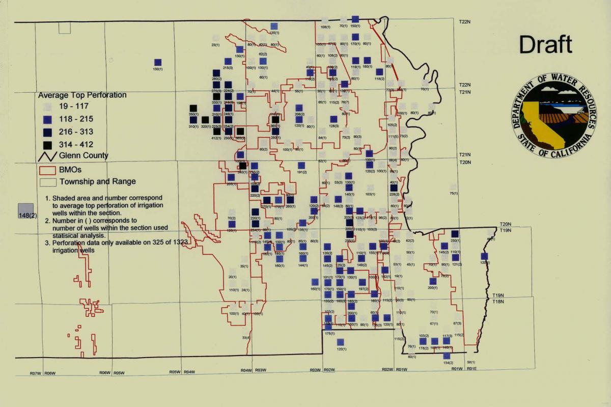
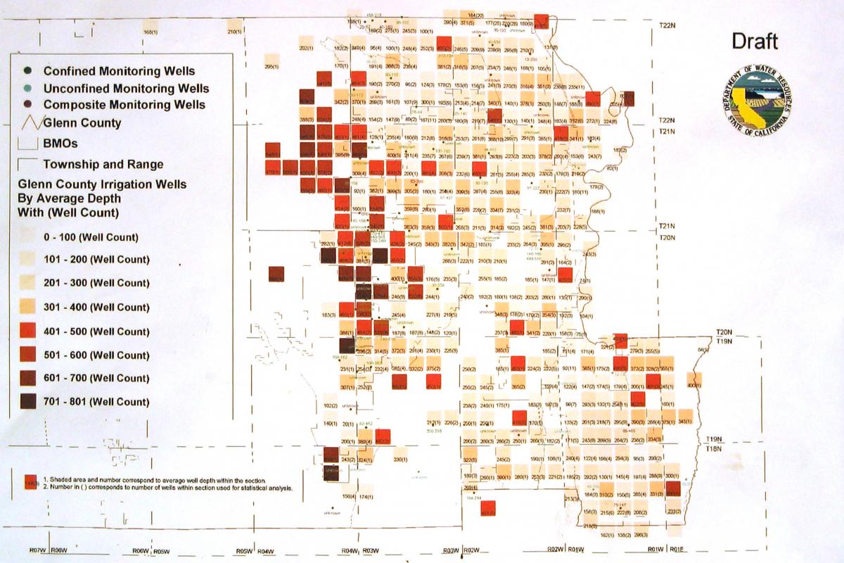
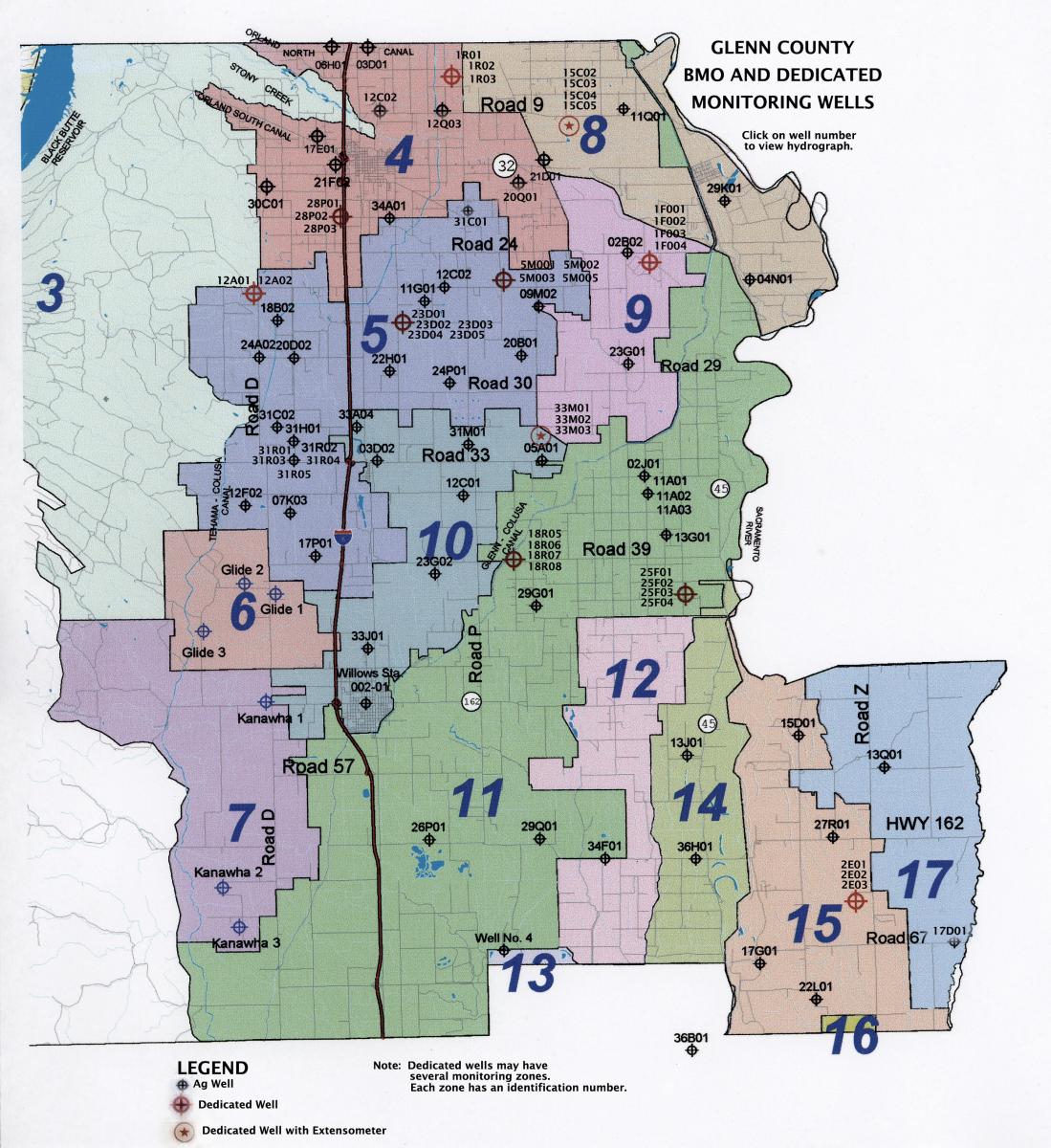
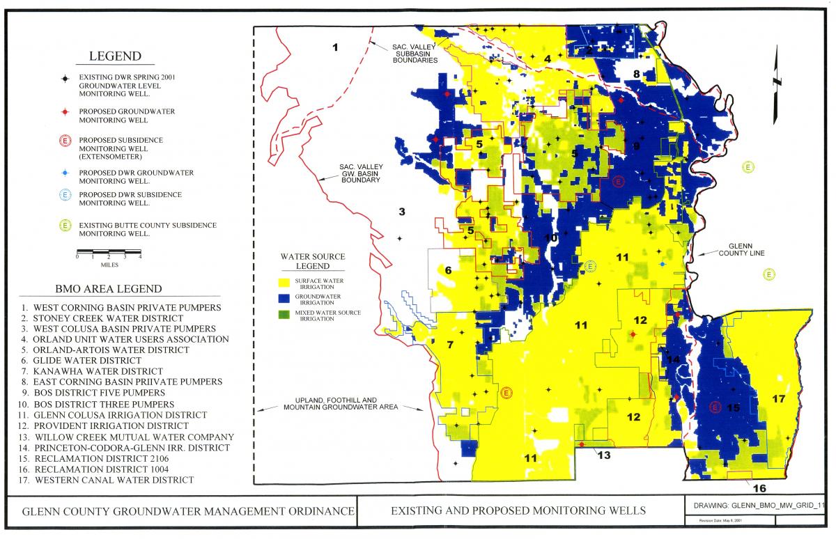
Dedicated Monitoring Wells
Updated:
| Attachment | Size |
|---|---|
| Dedicated Monitoring Wells (214.46 KB) | 214.46 KB |
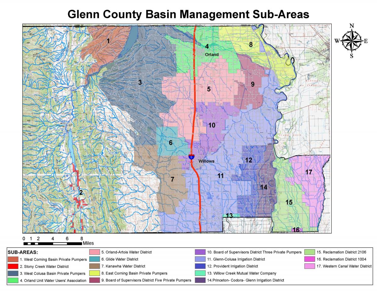
Glenn County BMO Sub-Areas
Updated:
| Attachment | Size |
|---|---|
| Glenn County BMO Sub-Areas (246.32 KB) | 246.32 KB |
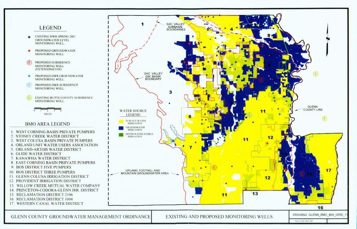
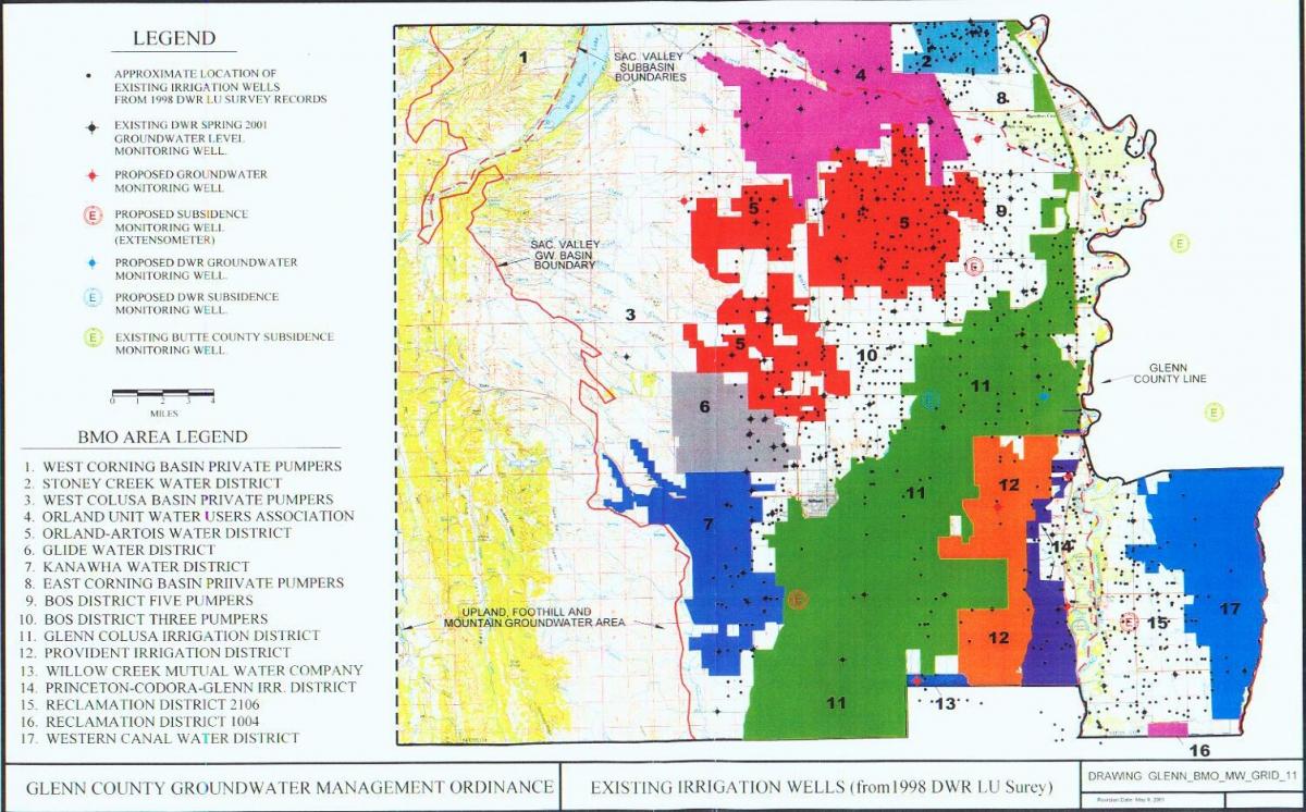
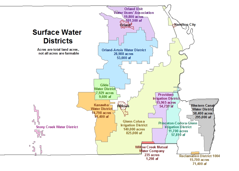
Map of Water Sources in Glenn County
Updated:
| Attachment | Size |
|---|---|
| Water Sources in Glenn County (164.7 KB) | 164.7 KB |
Public Notices - Glenn County Mosquito & Vector Control District
Updated:
| Attachment | Size |
|---|---|
| Notification Prior to Application 2015 (155.17 KB) | 155.17 KB |
Orland Area Of Concern Map 2009
Updated:
| Attachment | Size |
|---|---|
| Orland Area Of Concern Map 2009 (417.92 KB) | 417.92 KB |
Orland Area Of Concern Map 2005
Updated:
| Attachment | Size |
|---|---|
| Orland Area Of Concern Map 2005 (113.07 KB) | 113.07 KB |